Our Services
Your Trusted Partner in Preserving Land Ownership and Digitizing Boundaries for Future Security.
Affordable Aerial Mapping
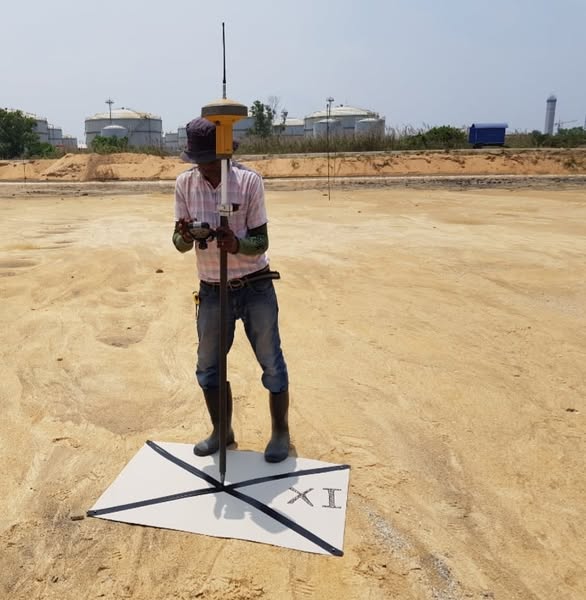
Aerial Drone Mapping:
Leverage advanced drone technology for high-precision aerial mapping. We provide mapping services such as
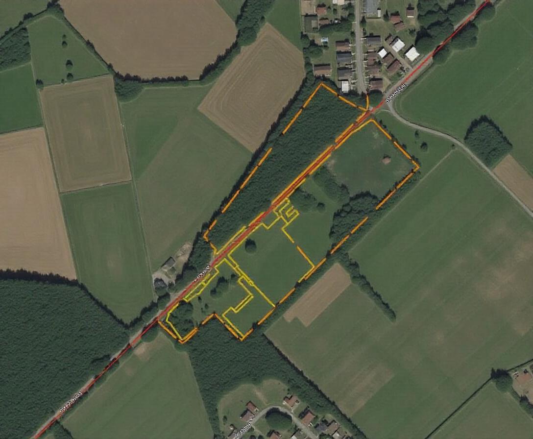
- Orthomosiac: Access and integrate real-time mapping data for seamless land analysis.
- Google Maps: Utilize Aerial imagery and 3D models for updated Google map and Earth land visualization.
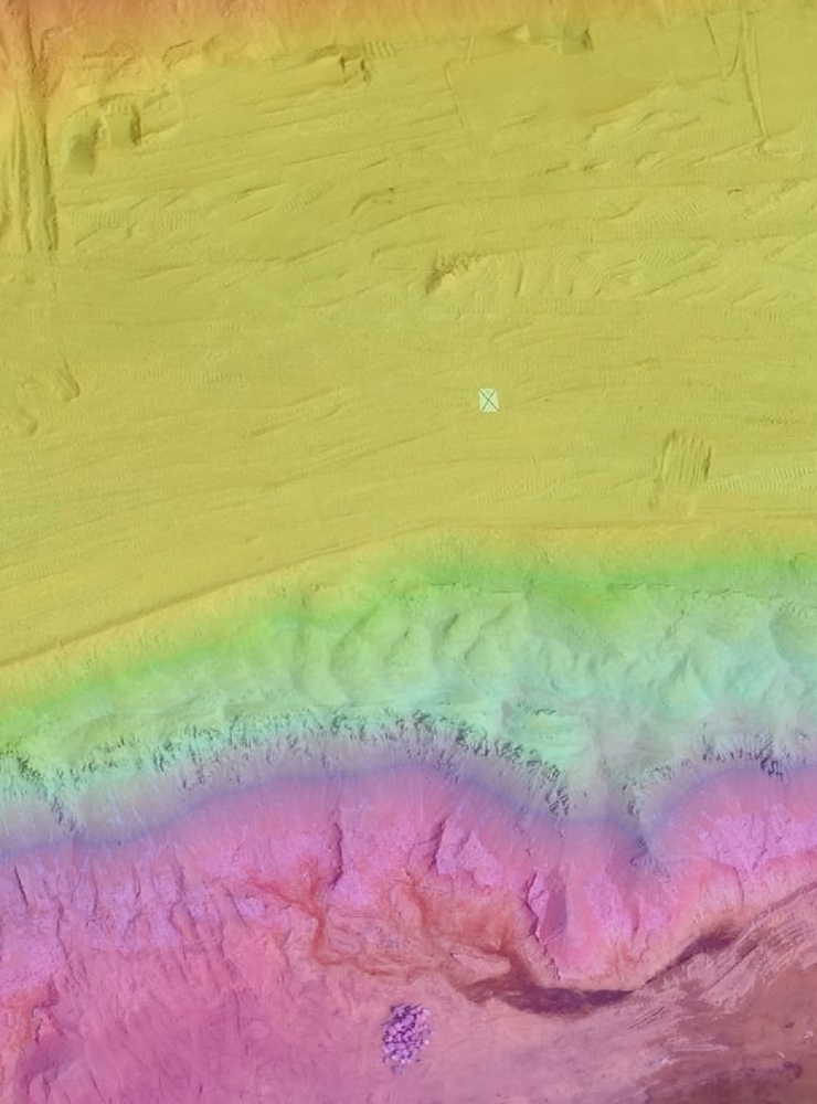
- LiDAR: Capture high-resolution 3D data for accurate topographical surveys and terrain mapping.
- Contour Mapping: Generate detailed contour maps to analyze land elevation and terrain features.
From $49.95
Cloud Based Land Data Storage
Cloud-based land data storage is a secure and scalable digital solution designed to store, manage, and access land-related data from anywhere in the world. This system provides a centralized platform for individuals, businesses, and governments to organize property records, land maps, survey data, and other geospatial information in a cloud environment.
Key features of cloud-based land data storage include:
- Accessibility: Access data on-demand via any internet-enabled device, ensuring flexibility and ease of use.
- Security: State-of-the-art encryption and data protection measures to safeguard sensitive land ownership and usage data.
- Collaboration: Share land data seamlessly with stakeholders, enabling efficient decision-making and transparent communication.
- Scalability: Expand storage capacity as needed without investing in physical infrastructure.
- Integration: Sync with Geographic Information Systems (GIS), cadastral databases, and other land management tools for comprehensive functionality.
From $9.95
Survey Verifications & Consultation
Survey Verifications & Consultation
Survey verifications and consultation services provide accurate validation of land survey data and expert advice for informed land-related decisions. These services ensure compliance with legal standards, resolve disputes, and assist in planning and development.
Key offerings include:
- Verifying survey accuracy, boundaries, and dimensions.
- Expert consultation on zoning, , and dispute resolution.
- Advanced tools like GIS and drones for precise mapping and analysis.
Ideal for developers, investors, and policymakers, these services streamline land transactions and project planning with reliable data and guidance.
From $49.95
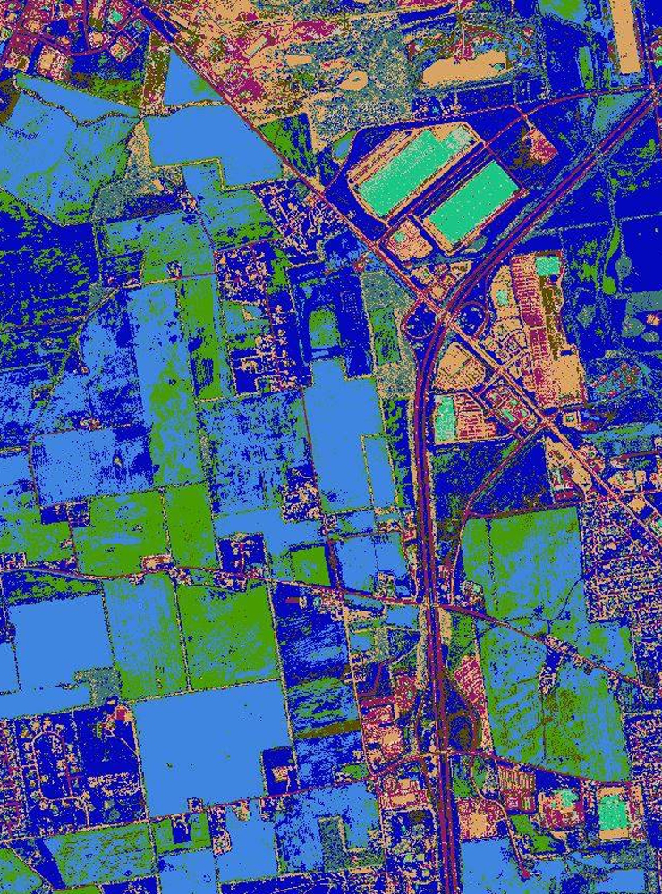
Archive GIS data
We offer a comprehensive collection of Archived GIS Data available for purchase, providing access to valuable geospatial information for historical reference, research, and planning. Our datasets include high-quality maps, land surveys, spatial analyses, and other critical geospatial data, meticulously archived for accuracy and relevance.
Why Choose Our Archived GIS Data?
- Wide Range of Datasets: Historical land use, property boundaries, environmental data, and more.
- Accurate and Reliable: Verified data ensures precision for your projects.
- Ready-to-Use Formats: Delivered in compatible GIS formats for seamless integration.
- Flexible Access: Purchase only the data you need or explore bulk options for extensive archives.
Whether you’re a developer, researcher, or policymaker, our archived GIS data empowers you with the insights needed for informed decision-making. Contact us today to explore available datasets and find the right data for your needs!
From $9.99
No More Encroachments
LandsVault is an essential tool in the fight against land encroachment, offering a secure platform for storing and managing land maps and property data. By digitally storing maps and legal documents, LandsVault ensures that land boundaries are accurately represented, making it easier to prove ownership and resolve disputes. With advanced aerial drone mapping, including Google Maps, Google Earth, and LiDAR technologies, users can clearly define land boundaries and monitor changes over time, making encroachment detection and prevention more effective.
Using LandsVault, landowners, governments, and organizations can track land use and protect their property against unauthorized encroachments. The secure digital vault allows for easy access to up-to-date land records, while its mapping tools enable comprehensive visual assessments of land status. With this system in place, landowners are empowered to take swift action against encroachment, ensuring the preservation of their property and preventing future unauthorized use.